
No products in the cart.


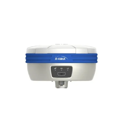
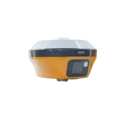
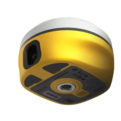
Support New Frequency Points B1C B2a And B2b Hi Target V5 Model Rtk Gnss Receiver With Good Price
In Stock
$2,800
In Stock
Description
Detail Information
| SBAS Positioning: | 0.5m | Power: | 2.6W |
|---|---|---|---|
| External Power Supply: | USB 15W Charging | GNSS Battery: | High-capacity Li-ion Battery 7000mAh, Working Time Is Better Than 15 Hours |
| Anti-drop: | Anti-2m High Measuring Rod Natural Drop | Water/dustproof: | IP68 Dustproof, Protected From Temporary |
| Humidity: | 100% Non-condensing | Storage Temperature: | -55℃~+85℃ |
| Operating Temperature: | -45℃~+75℃ | Cloud Services: | Device Management, Location Services, Collaborative Work, Data Analysis |
| Remote Service: | Message Push, Online Upgrade, Remote Control | Intelligence Application: | Intelligent Voice, Function Self-test |
| Advanced Function: | NFC IGRS, WebUI Interaction, U Disk Firmware Upgrade | ||
| Highlight: | V5 Rtk Gnss Receiver
, B1C Rtk Gnss Receiver , USB Rtk Gps Receiver |
||
Product Description
Product Description
Support new frequency points B1C, B2a, and B2b Hi Target V5 model rtk Gnss Receiver with good price .
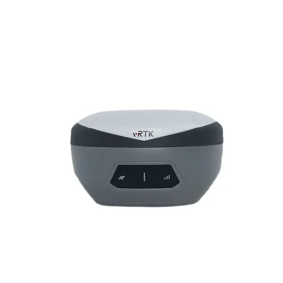
*the New IMU GNSS RTK with Visual Positioning Technology
Equipped with professional dual cameras, vRTK is Hi-Target’s first lightweight and innovative visual RTK receiver product, which not only enables non-contact image surveying, breaking through the objective constraints of previous work, but also improves the speed of stakeout with the function of Live View Stakeout. It greatly improves the work efficiency of engineering users.
* Dual Cameras for Image Survey and Live View Stakeout
Non-contact measurement greatly improves the usable range of GNSS and efficient safe operation.
*Strong Signal and High-quality Data
New generation GNSS SOC chip with 1408 channels, supports new frequency points B1C, B2a, and B2b RTK decoding for Beidou-3 Satellites.
Introduction of multi-frequency anti-jamming technology and multi-step adaptive filtering technology to ensure strong signals, high-quality data, fast fix, and high accuracy.
*Abundant Industry Data Results
Abundant types of data results meet the needs of different industry applications.
Compatible with the mainstream modelling software to attain point cloud and 3D modelling in one step.
Compatible with the mainstream modelling software to attain point cloud and 3D modelling in one step.
Specification
|
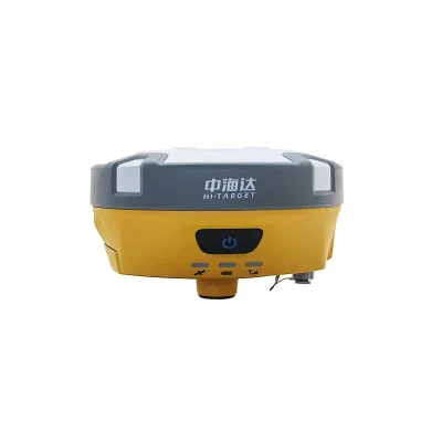
1408 Channels Dual Cameras Visual RTK Receiver V5/vRTK for Land Surveying
|
||
|
GNSS |
Satellite signals tracked simultaneously |
Channels: 1408
|
|
BeiDou: BDS : B1I,B2I,B3I,B1C,B2a,B2b
|
||
|
GPS: L1C/A,L1C,L2P(Y),L2C,L5
|
||
|
GLONASS: L1,L2
|
||
|
GALILEO: E1,E5a,E5b,E6
|
||
|
SBAS: L1,L2,L5
|
||
|
IRNSS :L5
|
||
|
QZSS : L1,L2,L5,L6
|
||
|
Support the PPP service
|
||
|
Output format
|
ASCII: NMEA-0183, binary data
|
|
|
Positioning output frequency
|
1-20Hz
|
|
|
Static data format
|
GNS and Rinex
|
|
|
Differential format
|
RTCM2.X,RTCM3.X
|
|
|
Network model
|
VRS, FKP, MAC; support NTRIP
|
|
|
System Configuration
|
Operating system
|
Linux
|
|
Data storage
|
Built-in 8GB ROM, support automatic cycle storage of static data
|
|
|
Accuracy and Reliability
|
RTK Positioning
|
Horizontal: ±(8+1×10⁻⁶D)mm
|
|
Vertical: ±(15+1×10⁻⁶D)mm
|
||
|
Static Positioning
|
Horizontal: ±(2.5+0.5×10⁻⁶D)mm
|
|
|
Vertical: ±(5+0.5×10⁻⁶D)mm
|
||
|
DGPS Positioning
|
Horizontal:±0.25m+1ppm
|
|
|
Vertical: ±0.50m+1ppm
|
||
|
SBAS Positioning
|
0.5m
|
|
|
Tilt measurement accuracy
|
8mm+0.7mm/°tilt
|
|
|
Image stakeout accuracy
|
Typical accuracy: 2cm
|
|
|
Image measurement accuracy
|
2cm ~ 4cm
|
|
|
initialization time
|
<10s
|
|
|
Initialization reliability
|
>99.99%
|
|
|
Continued test at breakpoint
|
RTK measurements are still available during differential signal interruptions
|
|
|
Camera |
Pixels
|
Professional Dual HD Camera, 2MP & 5MP
|
|
Futures
|
Support real scene stakeout, image measurement, working distance 2~15m
|
|
|
Communication |
Cellular mobile |
Built-in Sim card
Internal 4G mobile network:TDD-LTE,FDD-LTE,WCDMA,TD-SCDMA, EDGE,GPRS,GSM |
|
I/O ports
|
USB type C interface; SMA interface
|
|
|
WiFi
|
802.11 b/g access point and client mode, WiFi hotspot available
|
|
|
Bluetooth
|
Bluetooth® 4.0/2.1+EDR, 2.4GHz
|
|
|
Internal UHF transceiver radio |
Transmitting power: 0.5W/1W/2W adjustable
|
|
|
Frequency: 410MHz-470MHz
|
||
|
Protocol: HI-TARGET,TRIMTALK450S,TRIMMARKⅢTRANSEOT,SOUTH,CHC,SATEL
|
||
|
Bands: 116 bands(16 bands are configurable)
|
||
|
Working Range: Typically 7km
|
||
|
External UHF radio |
Transmitting power: 10W/30W adjustable
|
|
|
Working voltage: 9-16V
|
||
|
Frequency: 403MHz-473MHz
|
||
|
Protocol: HI-TARGET,TRIMTALK450S,TRIMMARKⅢTRANSEOT,SOUTH,CHC,SATEL
|
||
|
Bands: 116 bands(16 bands are configurable)
|
||
|
Transmission rate: 19.2kbps, 9.6kbps adjustable
|
||
|
Working Range: Typically 8-10 km ,optimal 15-20 km
|
||
|
Sensor |
Electronic bubble
|
Intelligent levelling
|
|
IMU Tilt survey |
Tilt correction system will continue to monitor the inclination of the centering rod, and compensate to correct the coordinates
|
|
|
User Interface
|
Button
|
Single button
|
|
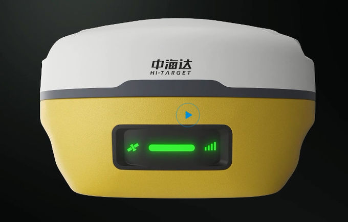
LED Lamp
|
LED light: satellite light, signal light, power light
|
|
|
Application Function |
Advanced function
|
NFC IGRS, WebUI interaction, U disk firmware upgrade
|
|
Intelligence application
|
intelligent voice, function self-test
|
|
|
Remote service
|
Message push, online upgrade, remote control
|
|
|
Cloud services
|
device management, location services, collaborative work, data analysis
|
|
|
Physical |
Operating temperature
|
-45℃~+75℃
|
|
Storage temperature
|
-55℃~+85℃
|
|
|
Humidity
|
100% non-condensing
|
|
|
Water/dustproof
|
IP68 dustproof, protected from temporary
|
|
|
Anti-drop
|
Anti-2m high measuring rod natural drop
|
|
|
GNSS battery
|
high-capacity li-ion battery 7000mAh, working time is better than 15 hours
|
|
|
External power supply
|
USB 15W charging
|
|
|
Dimensions
|
Φ130mm×80mm
|
|
|
Weight
|
≤0.97kg
|
|
|
Power
|
2.6W
|
|
|
Material
|
The shell is made of magnesium alloy material
|
|
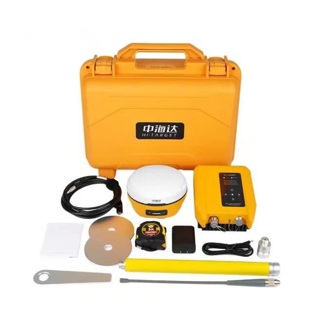
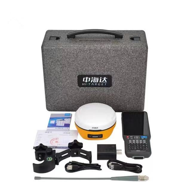
Packaging & Shipping

Our Services
1. Warranty: 12 months warranty is offered for survey equipment. 6 months warranty offered for survey accessory. Warranty comes in effective from the day your receive good.
2. Repair in warranty: We are responsible for supplying new parts for repairing. Round way freight will be charged by us. If it is necessary, product will be required to send back to our service center to be repaired, round way freight is charged by us. Our engineer will repair in your office for special case.
3. Repair out of warranty: We will offer related parts at commercial cost. Freight will be shared by us
4. Training and calibration: Our engineer is qualified for training and calibration for GNSS and Total Station on site. We offer this service to bulk order while customer has requirement.
5. Technical support is offered 24/365.
Reviews
There are no reviews yet.