

Subtotal: $284.00


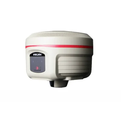
| Channels: | 336 Channels | Model: | Kolida K1 Pro |
|---|---|---|---|
| GPS: | L1, L1C, L2C, L2P, L5 | GLONASS: | G1, G2, G3 |
| Operating Temperature: | -25℃ ~ +65℃ | Humidity: | 100% Non-condensing |
| Waterproof/Dustproof: | IP68 Standard | Frequency Range: | 410 – 470MHz |
| Operating System: | Linux | Buttons: | Single Button |
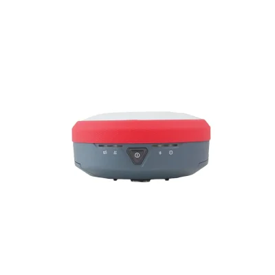
| Indicators: | 5 LED Indicators | ||
| Highlight: | GPS Base RTK GNSS Receiver
, Land Survey GPS GNSS Receiver , K1 Pro RTK GPS Receiver |
||
• Star-Fill Technology Now Available, to Overcome “Non-signal” Spots
• Star-link none-base positioning service (optional)
• Inertial Measurement + GNSS Positioning, Faster & Reliable
• OLED Color Screen, User Friendly Operation
• 10,000 mAh battery, A Whole-day Working With only One Recharge
Star-Fill, Save the signal-loss
This new function will let you continue working a few minutes when radio or mobile signal is becoming very poor or even lose in blind area, the accuracy is down to 2cm.
Work Faster, Wait Less
The Maxwell 7 GNSS engine inside K1 PRO provides an ultra-fast positioning speed, typically it starts tracking satellite signal within 5 seconds after turning on, coordinate can be acquired within 10 seconds.
Star-Link Correction Infinite Freedom
2cm Accuracy Star-Link correction service is available now! After subscribing to it, surveyors can work almost anywhere in the world without a base station or VRS network
Intertial Measurement, Fast and Flexible
The newly developed inertial tilt survey is no more affected by the earth’s magnetic field and requires no correction. The maximum tilt angle has been improved to 60 °, measurement speed is increased by over 30%.


|
Specification
|
||
|
GNSS Features
|
Channels
|
336
|
|
GPS
|
L1, L1C, L2C, L2P, L5
|
|
|
GLONASS
|
G1, G2, G3
|
|
|
BDS
|
BDS-2: B1I, B2I, B3I
|
|
|
BDS-3: B1I, B3I, B1C, B2a, B2b*
|
||
|
GALILEOS
|
E1, E5A, E5B, E6C, AltBOC*
|
|
|
SBAS
|
L1*
|
|
|
IRNSS
|
L5*
|
|
|
QZSS
|
L1, L2C, L5*
|
|
|
MSS L-Band (Reserve)
|
|
|
|
Positioning output rate
|
1Hz~20Hz
|
|
|
Initialization time
|
< 10s
|
|
|
Initialization reliability
|
> 99.99%
|
|
|
Positioning Precision |
Code differential
GNSS positioning
|
Horizontal: 0.25 m + 1 ppm RMS
|
|
Vertical: 0.50 m + 1 ppm RMS
|
||
|
GNSS static
|
Horizontal: 2.5 mm + 0.5 ppm RMS
|
|
|
Vertical: 5 mm + 0.5 ppm RMS
|
||
|
Real-time kinematic
|
Horizontal: 8 mm + 1 ppm RMS
|
|
|
(Baseline<30km)
|
Vertical: 15 mm + 1 ppm RMS
|
|
|
SBAS positioning
|
Typically < 5m 3DRMS
|
|
|
RTK initialization time
|
2 ~ 8s
|
|
|
IMU tilt compensation
|
Additional horizontal pole tip uncertainty
|
|
|
typically less than 10mm + 0.7 mm/° tilt down to 30°
|
||
|
IMU tilt angle
|
0° ~ 60°
|
|
|
Hardware Performance
|
Dimension
|
130.5mm(φ) × 84mm(H)
|
|
Weight
|
850g (battery included)
|
|
|
Material
|
Magnesium aluminum alloy shell
|
|
|
Operating temperature
|
-25℃ ~ +65℃
|
|
|
Storage temperature
|
-35℃ ~ +80℃
|
|
|
Humidity
|
100% Non-condensing
|
|
|
Waterproof/Dustproof
|
IP68 standard, protected from long time immersion to depth of 1m IP68 standard, fully protected against blowing dust
|
|
|
Shock/Vibration
|
Withstand 2 meters pole drop onto the cement ground naturally
|
|
|
Power supply
|
6-28V DC, overvoltage protection
|
|
|
Battery
|
Inbuilt 6800mAh rechargeable, removable Lithium-ion battery
|
|
|
Battery life
|
Single battery: 16h (static mode), 8h (Base + UHF), 12h (Rover + UHF), 15h (Rover + Bluetooth)
|
|
|
Communications
|
I/O Port
|
5PIN LEMO external power port + Rs232
|
|
Type-C interface (charge + OTG + Ethernet)
|
||
|
1 UHF antenna interface
|
||
|
SIM card slot (Micro SIM)
|
||
|
Internal UHF
|
Radio receiver and transmitter, 1W/2W/3W switchable
|
|
|
Frequency range
|
410 – 470MHz
|
|
|
Communication protocol
|
Farlink, Trimtalk450s, SOUTH, SOUTH+, SOUTHx, HUACE, Hi-target, Satel
|
|
|
Communication range
|
Typically 8km with Farlink protocol
|
|
|
Cellular mobile network
|
4G cellular module standard, customizable 5G module
|
|
|
Bluetooth
|
Bluetooth 3.0/4.1 standard, Bluetooth 2.1 + EDR
|
|
|
NFC Communication
|
Realizing close range (shorter than 10cm) automatic pair between receiver and controller (controller requires NFC wireless
communication module else)
|
|
|
WIFI
|
Modem
|
802.11 b/g standard
|
|
WIFI hotspot
|
Receiver broadcasts its hotspot form web UI accessing with any mobile terminals
|
|
|
WIFI datalink
|
Receiver can transmit and receive correction data stream via WiFi datalink
|
|
|
Data Storage/Transmission
|
Storage
|
8GB SSD internal storage standard, extendable up to 64GB
|
|
Automatic cycle storage (The earliest data files will be removed automatically while the memory is not enough)
|
||
|
Support external USB storage
|
||
|
The customizable sample interval is up to 20Hz
|
||
|
Data transmission
|
Plug and play mode of USB data transmission
|
|
|
Supports FTP/HTTP data download
|
||
|
Data format
|
Static data format: STH, Rinex2.01, Rinex3.02 and etc.
|
|
|
Differential data format: CMR, SCMRx, RTCM 2.1, RTCM 2.3, RTCM 3.0, RTCM 3.1, RTCM 3.2
|
||
|
GPS output data format: NMEA 0183, PJK plane coordinate, Binary code, Trimble GSOF
|
||
|
Network model support: VRS, FKP, MAC, fully support NTRIP protocol
|
||
|
Sensors
|
Electronic bubble
|
Controller software can display electronic bubble, checking leveling status of the carbon pole in real-time
|
|
IMU
|
Built-in IMU module, calibration-free and immue to magnetic interference
|
|
|
Thermometer
|
Built-in thermometer sensor, adopting intelligent temperature control technology, monitoring and adjusting the receiver
temperature
|
|
|
User Interaction
|
Operating system
|
Linux
|
|
Buttons
|
Single button
|
|
|
Indicators
|
5 LED indicators
|
|
|
Web interaction
|
With the access of the internal web interface management via WiFi or USB connection, users are able to monitor the receiver status
and change the configurations freely
|
|
|
Voice guidance
|
It provides status and operation voice guidance, and supports Chinese/English/Korean/Spanish/Portuguese/Russian/Turkish
|
|
|
Secondary development
|
Provides secondary development package, and opens the OpenSIC observation data format and interaction interface definition
|
|
|
Cloud service
|
The powerful cloud platform provides online services like remote manage, firmware update, online register and etc.
|
|

1. Warranty: 12 months warranty is offered for survey equipment. 6 months warranty offered for survey accessory. Warranty comes in effective from the day your receive good.
2. Repair in warranty: We are responsible for supplying new parts for repairing. Round way freight will be charged by us. If it is necessary, product will be required to send back to our service center to be repaired, round way freight is charged by us. Our engineer will repair in your office for special case.
3. Repair out of warranty: We will offer related parts at commercial cost. Freight will be shared by us
4. Training and calibration: Our engineer is qualified for training and calibration for GNSS and Total Station on site. We offer this service to bulk order while customer has requirement.
5. Technical support is offered 24/365.


Reviews
There are no reviews yet.