


Subtotal: $27,442.00


| Accuracy: | Horizontal: 8mm+1ppm; Vertical: 15mm+1ppm | Operaing System: | Linux |
|---|---|---|---|
| Operating Temperature:: | -45℃ ~ +75℃ | Communication Protocol: | Trimtalk450s, SOUTH, HUACE, Hi-target, Satel |
| Data Transmission:: | USB Data Transmission Supports FTP/HTTP Data Dow | IMU Tilt Angle: | 0° ~ 60° |
| Highlight: |
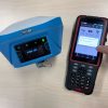
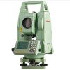
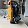
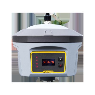
Galaxy G3 South total station equipment, Gnss Gps Receiver total station equipment, RTK total station instrument |
||


|
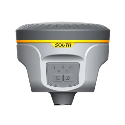
GNSS Features
|
Channels
|
1598
|
|
GPS
|
L1, L1C, L2C, L2P, L5
|
|
|
GLONASS
|
L1C/A,L1P,L2C/A,L2P,L3*
|
|
|
BDS
|
BDS-2: B1I, B2I, B3I
BDS-3: B1I, B3I, B1C, B2a, B2b* |
|
|
GALILEOS
|
E1, E5A, E5B, E6C, AltBOC*
|
|
|
SBAS
|
L1*
|
|
|
IRNSS
|
L5*
|
|
|
QZSS
|
L1, L2C, L5*
|
|
|
MSS L-Band
|
BDS-PPP
|
|
|
Positioning output rate
|
1Hz~20Hz
|
|
|
Initialization time
|
< 10s
|
|
|
Initialization reliability
|
> 99.99%
|
|
|
Positioning Precision
|
Code differential GNSS positioning
|
Horizontal: 0.25 m + 1 ppm RMS
Vertical: 0.50 m + 1 ppm RMS |
|
GNSS static
|
Horizontal: 2.5 mm + 0.5 ppm RMS
Vertical: 5 mm + 0.5 ppm RMS |
|
|
Real-time kinematic (Baseline<30km)
|
Horizontal: 8 mm + 1 ppm RMS
Vertical: 15 mm + 1 ppm RMS |
|
|
SBAS positioning
|
Typically < 5m 3DRMS
|
|
|
RTK initialization time
|
2 ~ 8s
|
|
|
IMU tilt compensation
|
Additional horizontal pole tip uncertainty typically less than 10mm + 0.7 mm/° tilt down to 30°
|
|
|
IMU tilt angle
|
0° ~ 60°
|
|
|
Hardware Performance
|
Dimension
|
130mm(W) ×130mm(L) × 80mm(H)
|
|
Weight
|
790g (battery included)
|
|
|
Material
|
Magnesium aluminum alloy shell
|
|
|
Operating temperature
|
-45℃ ~ +75℃
|
|
|
Storage temperature
|
-55℃ ~ +85℃
|
|
|
Humidity
|
100% Non-condensing
|
|
|
Waterproof/Dustproof
|
IP68 standard, protected from long time immersion to depth of 1m IP68 standard, fully protected against blowing dust
|
|
|
Shock/Vibration
|
Withstand 2 meters pole drop onto the cement ground naturally
|
|
|
Power supply
|
6-28V DC, overvoltage protection
|
|
|
Battery
|
Inbuilt 7.4V 6800mAh rechargeable, Li-ion battery
|
|
|
Battery life
|
15h (Rover Bluetooth mode)
|
|
|
Communications
|
I/O Port
|
5-PIN LEMO external power port + RS232 Type-C (charge, OTG to USB disk, data transfer with PC or phone, Ethernet) 1 UHF antenna TNC interface
|
|
Internal UHF
|
Receive 2W
|
|
|
Frequency range
|
410 – 470MHz
|
|
|
Communication protocol
|
Farlink, Trimtalk450s, SOUTH, HUACE, Hi-target, Satel
|
|
|
NFC Communication
|
Realizing close range (shorter than 10cm) automatic pair between receiver and controller (controller requires NFC wireless communication module else)
|
|
|
Bluetooth
|
Bluetooth 3.0/4.1 standard, Bluetooth 2.1 + EDR
|
|
|
WIFI
|
Modem
|
802.11 b/g standard
|
|
WIFI hotspot
|
AP mode, Receiver broadcasts its hotspot form web UI accessing with any mobile terminals
|
|
|
WIFI datalink
|
Client mode, Receiver can transmit and receive correction data stream via WiFi datalink
|
|
|
Data Storage/Transmission
|
Storage
|
4GB SSD Automatic cycle storage (The earliest data files will be removed automatically while the memory is not enough) Support external USB storage
|
|
Data transmission
|
Plug and play mode of USB data transmission
Supports FTP/HTTP data download |
|
|
Data format
|
Static data format: STH, Rinex2.01, Rinex3.02 and etc.
Differential format: RTCM 2.3, RTCM 3.0, RTCM 3.1, RTCM 3.2 GPS output data format: NMEA 0183, PJK plane coordinate, SOUTH Binary code Network model support: VRS, FKP, MAC, fully support NTRIP protocol |
|
|
Sensors
|
Electronic bubble
|
Controller software can display electronic bubble, checking leveling status of the carbon pole in real-time
|
|
IMU
|
Built-in IMU module, calibration-free and immue to magnetic interference
|
|
|
Thermometer
|
Built-in thermometer sensor, adopting intelligent temperature control technology, monitoring and adjusting the receiver temperature
|
|
|
User Interaction
|
Operating system
|
Linux
|
|
Buttons
|
One button
|
|
|
Indicators
|
2 LED indicators
|
|
|
Web interaction
|
With the access of the internal web interface management via WiFi or USB connection, users are able to monitor the receiver status and change the configurations freely
|
|
|
Voice guidance
|
It provides status and operation voice guidance, and supports Chinese/English/Korean/Spanish/Portuguese/Russian/Turkish
|
|
|
Secondary development
|
Provides secondary development kit, and opens the OpenSIC observation data format and interaction interface definition
|
|
|
Cloud service
|
The powerful cloud platform provides online services like remote manage, firmware update, online register and etc.
|

1. Warranty: 12 months warranty is offered for survey equipment. 6 months warranty offered for survey accessory. Warranty comes in effective from the day your receive good.
2. Repair in warranty: We are responsible for supplying new parts for repairing. Round way freight will be charged by us. If it is necessary, product will be required to send back to our service center to be repaired, round way freight is charged by us. Our engineer will repair in your office for special case.
3. Repair out of warranty: We will offer related parts at commercial cost. Freight will be shared by us
4. Training and calibration: Our engineer is qualified for training and calibration for GNSS and Total Station on site. We offer this service to bulk order while customer has requirement.
5. Technical support is offered 24/365.


Reviews
There are no reviews yet.