
No products in the cart.


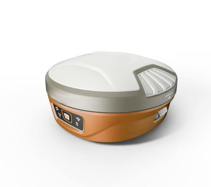
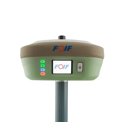
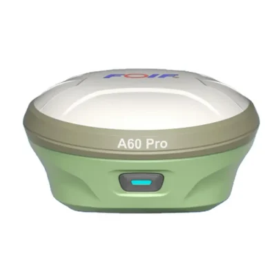
FOIF N90 GPS Dual Frequency RTK GNSS Receiver For Base 555 Channels IMU Tilt Survey
In Stock
$2,800
In Stock
Description
Detail Information
| Channels: | 555 Channels | Model: | Foif N90 |
|---|---|---|---|
| GNSS Board: | NovAtel OEM 729 | Satellites GPS: | L1 C/A, L1C, L2C, L2P, L5 |
| Satellites GLONASS: | L1 C/A, L2 C/A, L2P, L3, L5 | BeiDou: | B1, B2, B3 |
| Galileo: | E1, E5 AltBOC, E5a, E5b, E6 | SBAS: | Horizon: 60cm(1.97ft); Vertical: 120cm(3.94ft) |
| Real-Time DGPS Position: | Horizon: 40cm(1.31ft); Vertical: 80cm(2.62ft) | Real-Time Kinematic Position: | Horizontal: 1cm(0.03ft)+1.0ppm; Vertical: 2.5cm(0.08ft)+1.0ppm |
| Instant-RTK Intialization: | Typically <10s (Intialization For Base Lines <20km) 99.9% Reliability | RTK Intialization Range: | >40km |
| Highlight: | Tilt Survey RTK Receiver
, Dual Frequency RTK GPS Receiver , 555 Channels GPS GNSS Receiver |
||
Product Description
High Performance Cheap Price FOIF N90 GPS Dual Frequency RTK GNSS Receiver for Base Rover 555 Channels IMU Tilt Survey
Product Description
Function Feature
1. Compact design, more productive
2. Professional GNSS satellites tracked simultaneously( GPS, Glonass, Galileo, Beidou)
3. Automatic data collection during centering
4. When the pole is tilted in 30 degrees, N90 still could get the right point data by automatic correct system.
5. Applies WIFI connection to realize WebUI control designed to modify settings and monitor the receiver status
6. Bundled Android field software brings a big change in user experience and accessibility
Performance Feature
1. Performance values assume minimum of five satellites, following the procedures recommended in the product manual,
High-multipath areas, high PDOP values and periods of severe atmospheric conditions may degrade performance.
*2. Long baselines, long occupations, precise ephemeris used.
FOIF Geomatics CAD
Main functions include:
DWG file format, compatible with AutoCAD Integrated transformation and grid system computations
Full 3D least squares adjustment, blunder detection, graphical elipse display
DTM contouring/Modeling volumes/3D rendering
Site Design: Ponds, ditches, stockpiles and siopes
Road Design: horizontal and vertical alignments, cross sectional templates
Completely customizable user interface
* Toolbars-can be arranged with “drag and drop” functionality
* Menus- can be re-organized with our graphical menu editor
* Screen- items can be turned off for more graphics area
* Layout- of command window- top or bottom
Reporting, exporting and printing
Reporting, exporting and printing
Technical parameter
|
Items
|
Specification
|
|
|
GNSS Engine
|
GNSS board
|
NovAtel OEM 729
|
|
Channel
|
555
|
|
|
Satellites
|
GPS: L1 C/A, L1C, L2C, L2P, L5
|
|
|
GLONASS: L1 C/A, L2 C/A, L2P, L3, L5
|
||
|
BeiDou: B1, B2, B3
|
||
|
Galileo: E1, E5 AltBOC, E5a, E5b, E6
|
||
|
NavlC (IRNSS): L5
|
||
|
SBAS: L1, L5
|
||
|
QZSS: L1 C/A, L1C, L2C, L5, L6
|
||
|
L-Band: Up to 5 channels
|
||
|
Trimble BD990 optional
|
||
|
Real-Time Accuracy(rms)
|
SBAS
|
Horizon: 60cm(1.97ft); Vertical: 120cm(3.94ft)
|
|
Real-Time DGPS position
|
Horizon: 40cm(1.31ft); Vertical: 80cm(2.62ft)
|
|
|
Real-Time Kinematic Position
|
Horizontal: 1cm(0.03ft)+1.0ppm; Vertical: 2.5cm(0.08ft)+1.0ppm
|
|
|
Real-Time Performance
Stop and Go solution
|
Instant-RTK Intialization
|
Typically <10s (Intialization for base lines <20km)
99.9% reliability
|
|
RTK Intialization range
|
>40km
|
|
|
Post Processing Accuracy(rms)
|
Static, Rapid Static
|
Horizontal: 2.5mm(0.008ft) +1.0ppm;
Vertical: 5mm(0.016ft)+1.0ppm
|
|
Post-processing Kinematic
|
Horizontal: 10mm(0.033ft)+1.0ppm; Vertical: 20mm(0.066ft)+1.0ppm
|
|
|
Solutions
Field Software Suite |
Surpad software
|
Main function include: A90 GNSS Support: configuration, monitoring and control
|
|
Volume computation, Background raster image
|
||
|
Network connectivity, Coordinate System Support: predefined grid systems, predefined datums
|
||
|
projections, Geoids, local grid
|
||
|
Map view with colored lines Geodetic Geometry: intersection, azimuth/distance, offsetting, poly-line, curve, area
|
||
|
Road Construction (3D): Survey Utilities: calculator, RW5 file
|
||
|
Viewing: Data import/Export: DXF, SHP, RW5
|
||
|
Data logging
|
Recording Interval
|
0.1-999 seconds
|
|
Physical
|
Flat design
|
|
|
Size
|
156mm*76mm
|
|
|
Bottom cover
|
Aluminum magnesium alloy
|
|
|
Memory
|
Internal memory
|
8GB standard; supports extending to 32GB
|
|
I/O Interface
|
TNC port
|
connecting built-in radio antenna
|
|
5-pin lemo port
|
connecting external power supply and external radio
|
|
|
7-pin lemo port
|
(USB+serial port): connecting PC and handheld
|
|
|
Operating system
|
Linux
|
Based on Linux; Supports Web UI
|
|
Voice
|
Multi-language supported
|
|
|
Tilt survey sensor
|
Automatic correct system by 30 degree
|
|
|
Data format
|
Data format
|
RTCM 2.3
RTCM 3.0.RTCM 3.X CMR, CMR+ NovAtelX/5CMRx |
|
Operation
|
Operation
|
RTK rover/base, post-processing
|
|
RTK Network rover
|
VRS, FKP, MAC
|
|
|
Point-to-point GPRS through Real-time Data
|
||
|
Server Software (internal GPRS or external cell phone)
|
||
|
LandXML (FOIF Field Genius support)
|
Total Station support ( FOIF Field Genius)
|
|
|
Import and stake directly from a DXF File (FOIF Field Genius)
|
||
|
Office Software
|
Main functions include: Network post-processing
|
|
|
Integrated transformation and grid system computations
|
||
|
Pre-defined datums along with use-defined capabilities
|
||
|
Survey mission planning
|
||
|
Automatic vector processing
|
||
|
Least-squares network adjustment
|
||
|
Data analysis and quality control tools
|
||
|
Coordinate transformations
|
||
|
Reporting
|
||
|
Exporting
|
||
|
Geoid
|
||
|
Environmental
|
Operating temperature
|
-30ºC to +65ºC(-22°F to 149°F)
|
|
Storage temperature
|
-40ºC to +80ºC(-40°F to 176°F)
|
|
|
Humidity
|
100% condensing
|
|
|
Waterproof
|
IP67 (IEC60529)
|
|
|
Shock
|
2m (6.56ft) pole drop
1.2m (3.94ft) free drop |
|
|
Power
|
7.2v.2 removable batteries (total up to 6800mAh, supports single battery working)
|
|
|
Optional System Components
|
Communication Module
|
Internal radio: UHF Link (410-470MHz)
1W
|
|
External radio
|
R*&*both (5w/35w selectable)
|
|
|
4G LTE module (EC25 series)
|
Fits various networks
|
|
|
Bluetooth
|
2.1+EDR Class 2
|
|
|
WiFi
|
IEEE 802.11 b/g/n
|
|
|
Antenna
|
Built-in antenna, integrating GNSS, BT/WLAN and network antenna
|
|
|
Controller
|
F58
|
|
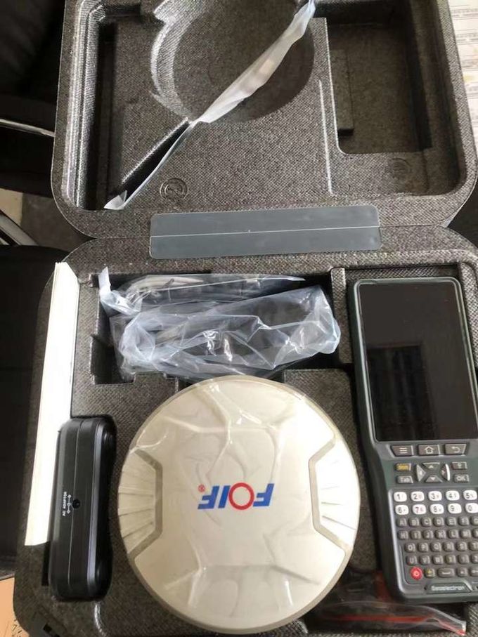
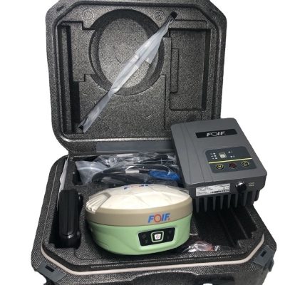
Packaging & Shipping

Our Services
1. Warranty: 12 months warranty is offered for survey equipment. 6 months warranty offered for survey accessory. Warranty comes in effective from the day your receive good.
2. Repair in warranty: We are responsible for supplying new parts for repairing. Round way freight will be charged by us. If it is necessary, product will be required to send back to our service center to be repaired, round way freight is charged by us. Our engineer will repair in your office for special case.
3. Repair out of warranty: We will offer related parts at commercial cost. Freight will be shared by us
4. Training and calibration: Our engineer is qualified for training and calibration for GNSS and Total Station on site. We offer this service to bulk order while customer has requirement.
5. Technical support is offered 24/365.


Reviews
There are no reviews yet.