
Subtotal: $7,000.00


Cheaper Price Easy Operate Garmin Etrex 10 Worldwide Handheld GPS Quality
In Stock
$155.00
In Stock
Description
Detail Information
| Display Resolution,WxH: | 128 X 160 Pixels | Display Type: | Transflective, Monochrome |
|---|---|---|---|
| Battery: | 2 AA Batteries (not Included); NiMH Or Lithium Recommended | Battery Life: | 25 Hours |
| Water Rating: | IPX7 | High-sensitivity Receiver: | Yes |
| Interface: | USB | Waypoints/favorites/locations: | 1000 |
| Routes: | 50 | Geocaching-friendly: | Yes (Paperless) |
| Area Calculation: | Yes | Hunt/fish Calendar: | Yes |
| Sun And Moon Information: | Yes | ||
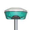
| Highlight: | Land Survey GPS Receiver
, Etrex 10 RTK GPS Receiver , Transflective Display GPS Navigator |
||
Product Description
Product Description
Cheaper price easy operate Garmin Etrex 10 Worldwide Handheld GPS quality

Garmin eTrex 10 handheld GPS
- Worldwide basemap
- 2.2″ monochrome display, easy to read in any light
- GPS and GLONASS satellites for faster positioning
- Paperless geocaching
- 25-hour battery life with 2 AA batteries
eTrex 10 retains the core functionality, rugged construction, affordability and long battery life that made eTrex the most dependable GPS device available. We improved the user interface and added a worldwide basemap, paperless geocaching and support for spine-mounting accessories.
See the Way
eTrex 10 has an enhanced 2.2″ monochrome display that’s easy to read in any lighting situation. Both durable and water resistant, eTrex 10 is built to withstand the elements. Its easy-to-use interface means you’ll spend more time enjoying the outdoors and less time searching for information. eTrex 10 features the legendary toughness that’s built to withstand the elements. Dust, dirt, humidity, water — none are a match for this navigator.
Find Fun
eTrex 10 supports geocaching GPX files for transferring geocaches. Visit OpenCaching to start your geocaching adventure. By going paperless, you’re not only helping the environment but also improving efficiency. eTrex 10 stores and displays key information, including location, terrain, difficulty, hints and descriptions, which means no more manually entering coordinates and paper printouts. Simply upload the GPX file to your eTrex 10 and start hunting for caches.
Keep Your Fix
With its high-sensitivity, WAAS-enabled GPS receiver and HotFix® satellite prediction, eTrex 10 locates your position quickly and precisely and maintains its GPS location even in heavy cover and deep canyons. Whether you’re in deep woods or just near tall buildings and trees, you can count on eTrex 10 to help you find your way when you need it the most.
Go Global
eTrex devices are the first-ever consumer-grade receivers that can track both GPS and GLONASS satellites simultaneously. When using GLONASS satellites, the time it takes for the receiver to “lock on” to a position is (on average) approximately 20 percent faster than using GPS. And when using both GPS and GLONASS, the receiver has the ability to lock on to 24 more satellites than using GPS alone.
Plan Your Next Trip
Take charge of your next adventure with BaseCamp™, software that lets you view and organize maps, waypoints, routes, and tracks. This free trip-planning software even allows you to create Garmin Adventures that you can share with friends, family or fellow explorers. BaseCamp displays topographic map data in 2-D or 3-D on your computer screen, including contour lines and elevation profiles.
| General | |
| Physical dimensions | 2.1″ x 4.0″ x 1.3″ (5.4 x 10.3 x 3.3 cm) |
| Display size, WxH | 1.4″ x 1.7″ (3.6 x 4.3 cm); 2.2″ diag (5.6 cm) |
| Display resolution, WxH | 128 x 160 pixels |
| Display type | transflective, monochrome |
| Weight | 5 oz (141.7 g) with batteries |
| Battery | 2 AA batteries (not included); NiMH or Lithium recommended |
| Battery life | 25 hours |
| Water rating | IPX7 |
| High-sensitivity receiver | Yes |
| Interface | USB |
| Maps & Memory | |
| Basemap | Yes |
| Custom POIs (ability to add additional points of interest) |
Yes |
| Waypoints/favorites/locations | 1000 |
| Routes | 50 |
| Track log | 10,000 points, 100 saved tracks |
| Outdoor Features | |
| Geocaching-friendly | Yes (Paperless) |
| Hunt/fish calendar | Yes |
| Sun and moon information | Yes |
| Area calculation | Yes |
| Garmin Connect | |
| Garmin Connect compatible (online community where you analyze, categorize and share data) |
Yes |
Packaging & Shipping

Our Services
1. Warranty: 12 months warranty is offered for survey equipment. 6 months warranty offered for survey accessory. Warranty comes in effective from the day your receive good.
2. Repair in warranty: We are responsible for supplying new parts for repairing. Round way freight will be charged by us. If it is necessary, product will be required to send back to our service center to be repaired, round way freight is charged by us. Our engineer will repair in your office for special case.
3. Repair out of warranty: We will offer related parts at commercial cost. Freight will be shared by us
4. Training and calibration: Our engineer is qualified for training and calibration for GNSS and Total Station on site. We offer this service to bulk order while customer has requirement.
5. Technical support is offered 24/365.


Reviews
There are no reviews yet.